
Satellites reveal Earth’s ice is vanishing faster than ever, altering oceans, climate, and even volcanic activity. The NISAR mission will track these changes in unprecedented detail.
©NASA
Earth’s ice is melting faster than ever. Antarctica, Greenland, and the Alpine glaciers are shedding mass at an alarming pace, triggering consequences that ripple far beyond the poles. And now, satellites are painting a clearer picture than ever of the scale of this global shift.
A planet reshaped by melting ice
Each year, Greenland loses around 294 billion tons (267 billion metric tons) of ice. Antarctica? Roughly 150 billion tons (136 billion metric tons) annually. These staggering figures, reported by NASA and the National Snow and Ice Data Center (NSIDC), aren’t just abstract data points — they’re reshaping the world in real time.
As the ice melts, sea levels rise, ocean currents shift, and climate patterns grow increasingly unstable. The Atlantic Meridional Overturning Circulation (AMOC), a system that regulates temperatures across the Northern Hemisphere, is being disrupted. That’s not a footnote; it’s a potential climate domino with global consequences.
In Antarctica, the year 2024 brought an extreme heat wave that pushed temperatures up to 50°F (28°C) above seasonal averages — and that’s in a region that isn’t exactly known for warmth. Sea ice plummeted to record lows. Meanwhile, the Alpine glaciers have lost 40% of their volume between 2000 and 2023. This isn’t just climate change. It’s a planetary transformation, unfolding live.
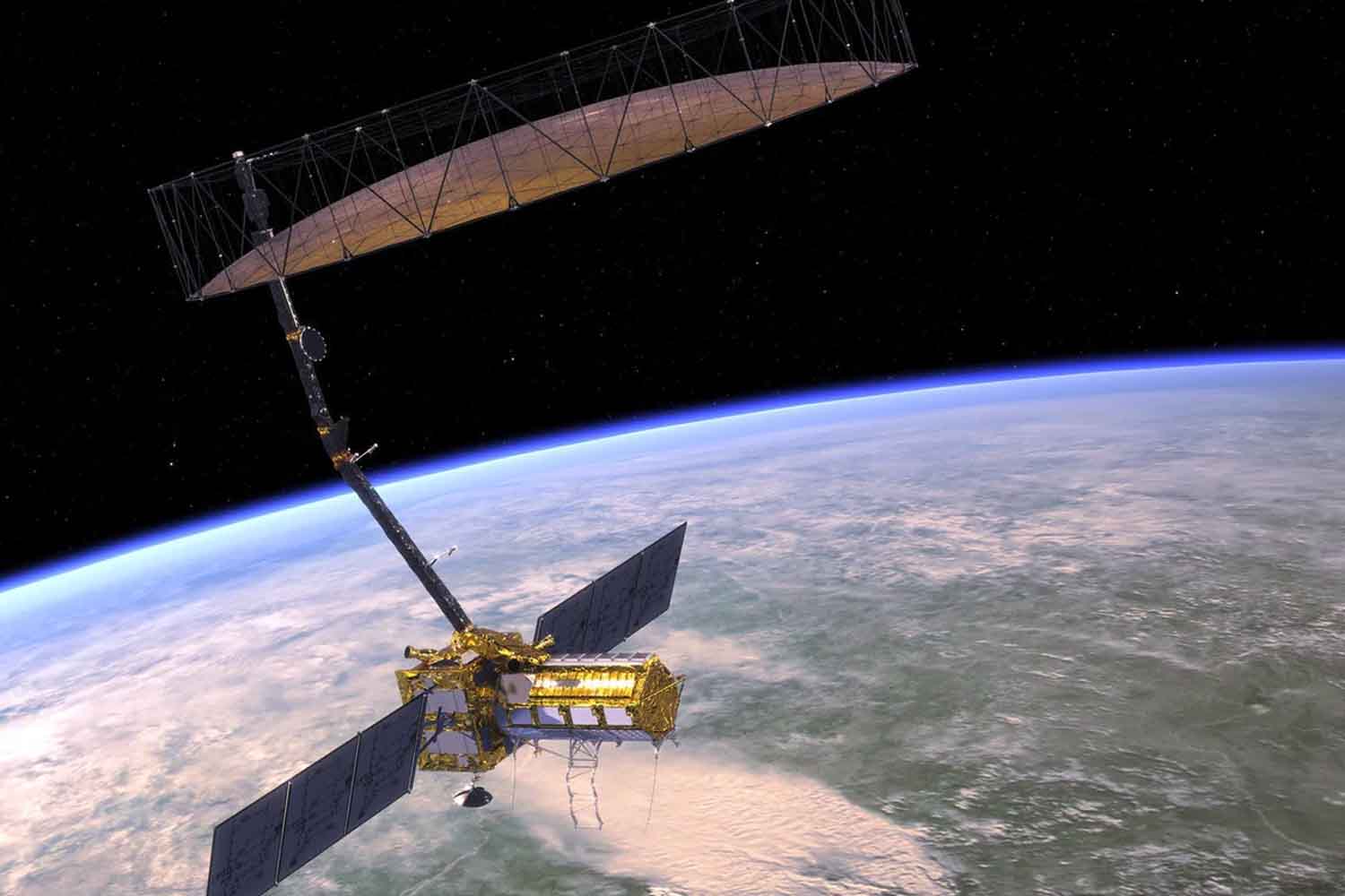
A billion-dollar satellite that sees through clouds, forests and darkness
To grasp the full extent of what’s happening — and to act fast — scientists are turning their gaze toward space. Enter NISAR, a joint mission between NASA and the Indian Space Research Organisation (ISRO) that could redefine how we observe Earth’s surface.
Scheduled to launch July 30, 2025 from India’s Satish Dhawan Space Center, NISAR is the most expensive radar satellite ever built, clocking in at over $1.6 billion (1.5 billion euros). But it’s not just the price tag that’s historic.
Armed with dual-frequency radar — L-band from NASA, S-band from ISRO — the satellite will measure ground movement with sub-inch accuracy every 12 days, covering nearly the entire planet. That includes changes invisible to the human eye and impossible to detect with traditional instruments.
And here’s the kicker: it doesn’t need clear skies. Thanks to its Synthetic Aperture Radar (SAR), NISAR can “see” through clouds, smoke, vegetation, and even darkness. Its 40-foot-wide (12-meter) antenna will detect everything from glacial shifts to landslides and earthquakes, day and night.
When polar ice melts, the whole world feels it
Forget the image of melting ice as a problem reserved for polar bears. NISAR is poised to impact agriculture, disaster response, and even our understanding of Earth’s carbon cycles.
By tracking soil moisture levels, the satellite will help farmers in vulnerable regions manage crops more efficiently and enhance food security. The radar’s ability to penetrate dense vegetation will also refine our estimates of biomass and carbon storage — crucial metrics for climate strategy.
And there’s a more volatile dimension to all this. As ice melts and pressure on the Earth’s crust decreases, volcanic activity might increase, particularly in places like Antarctica. A recent study revealed the presence of hundreds of potentially active volcanoes hidden beneath the Antarctic ice. Losing that icy blanket could destabilize them, opening up a whole new chapter in the story of climate risk.
“It’s not just about rising seas or shrinking glaciers,” one NASA researcher noted. “We’re talking about the Earth’s entire system responding to the loss of ice.”
Fonte: NASA